| Jurisdiction | Multitemporal ALS coverage |
|---|---|
| Alberta (AB) | 287,720 (44.8%) |
| British Columbia (BC) | 82,252 (8.9%) |
| New Brunswick (NB) | 26,868 (37.6%) |
| Newfoundland and Labrador (NL) | 170 (0%) |
| Nova Scotia (NS) | 19,552 (36.7%) |
| Ontario (ON) | 14,166 (1.5%) |
| Prince Edward Island (PE) | 5,554 (98.1%) |
| Quebec (QC) | 173,409 (12.7%) |
| Saskatchewan (SK) | 3,482 (0.6%) |
| Yukon Territory (YT) | 27 (0%) |
Multitemporal data
Static maps
Multitemporal data
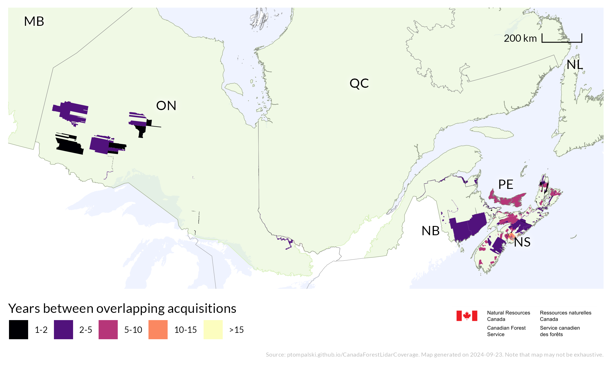
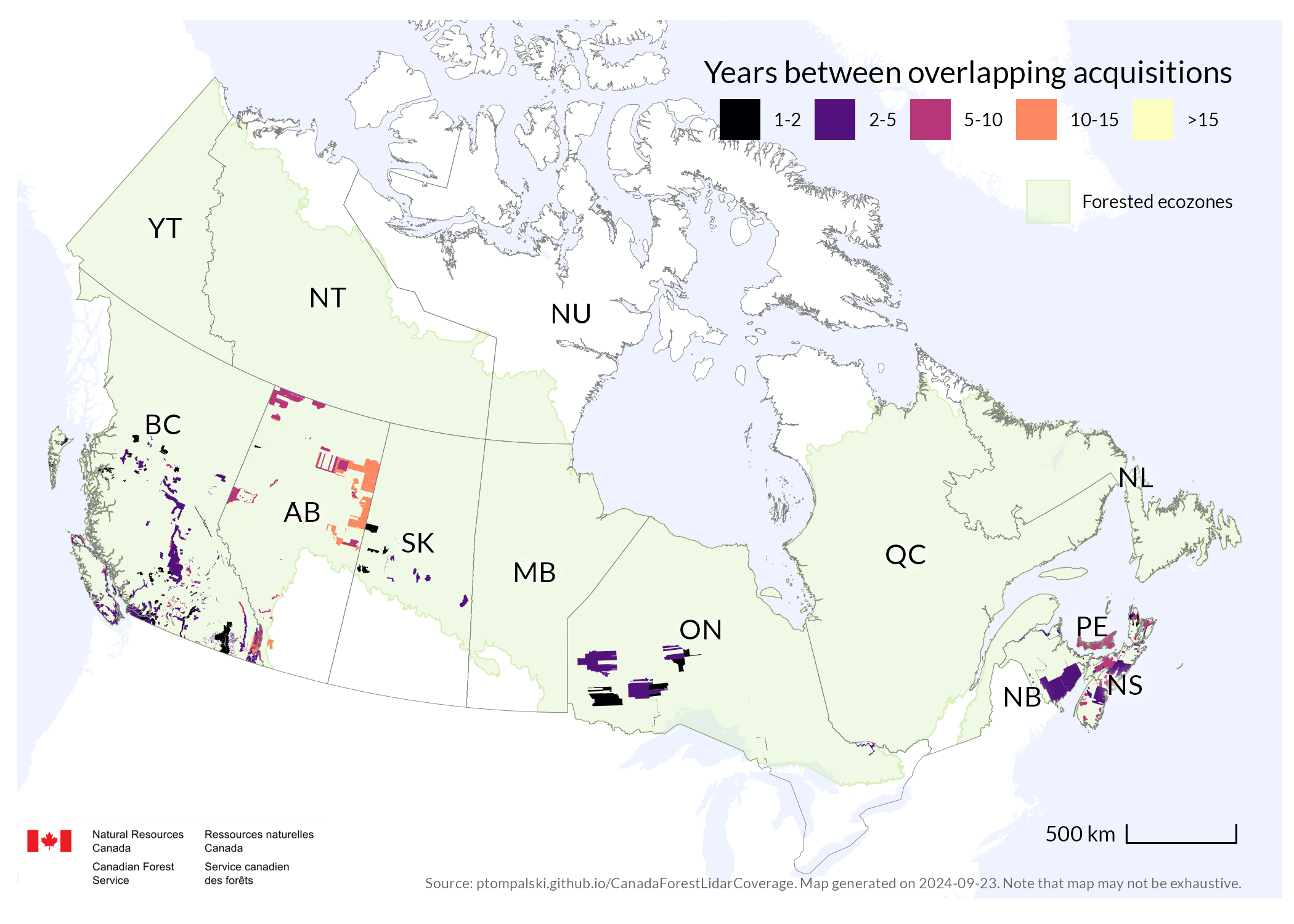
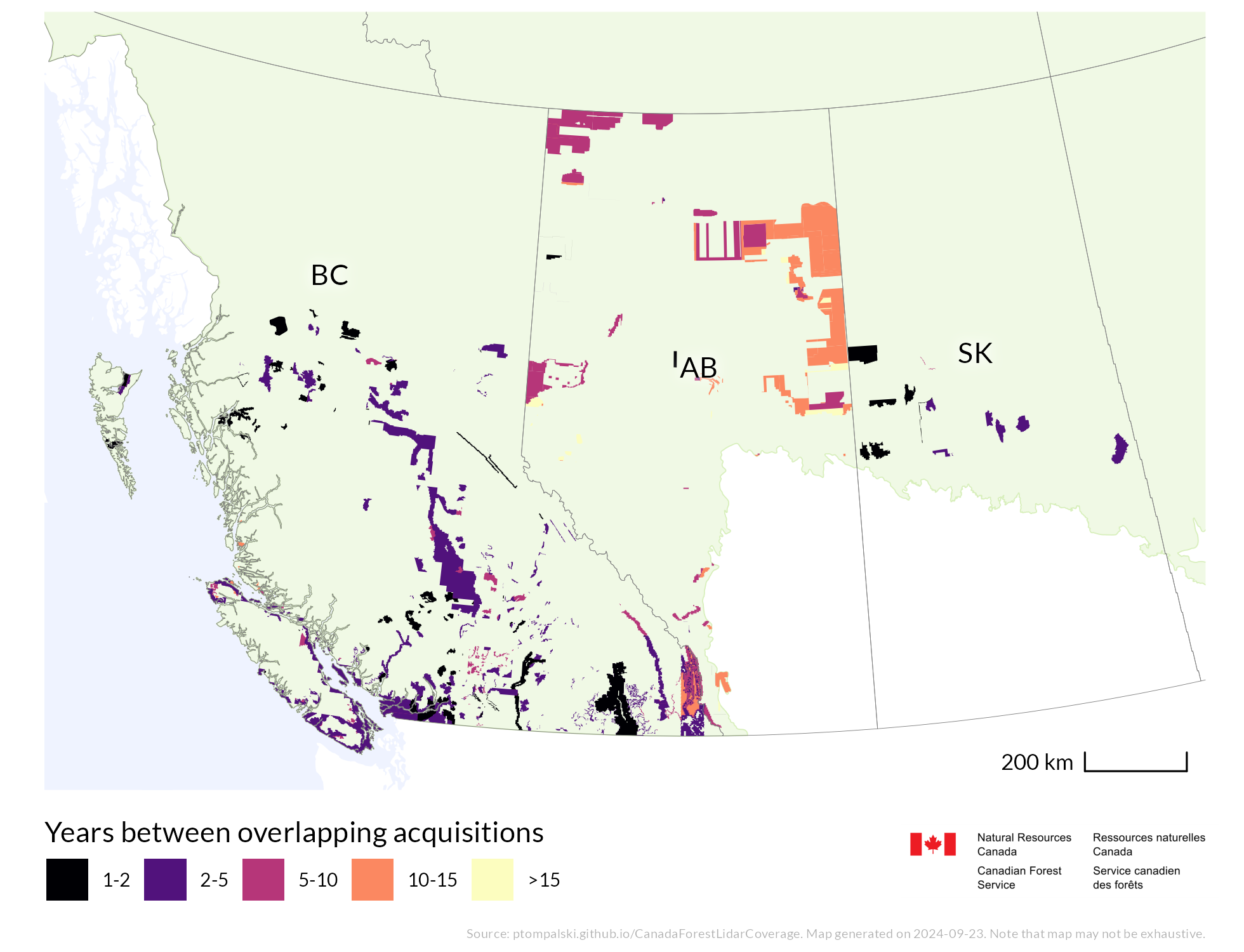
National and regional static map products show ALS coverage, point density, acquisition timing, and multitemporal overlap. They are updated as new acquisitions are added to the compilation.
An area of 613201.5 km2 has been surveyed more than once using ALS, providing multitemporal coverage that represents about 11.3% of Canada’s land area and 24.8% of managed forests.
Areas of multiple acquisitions
National extent
Western regional extent
Eastern regional extent