Detailed maps - western Canada
Static maps
Western Canada
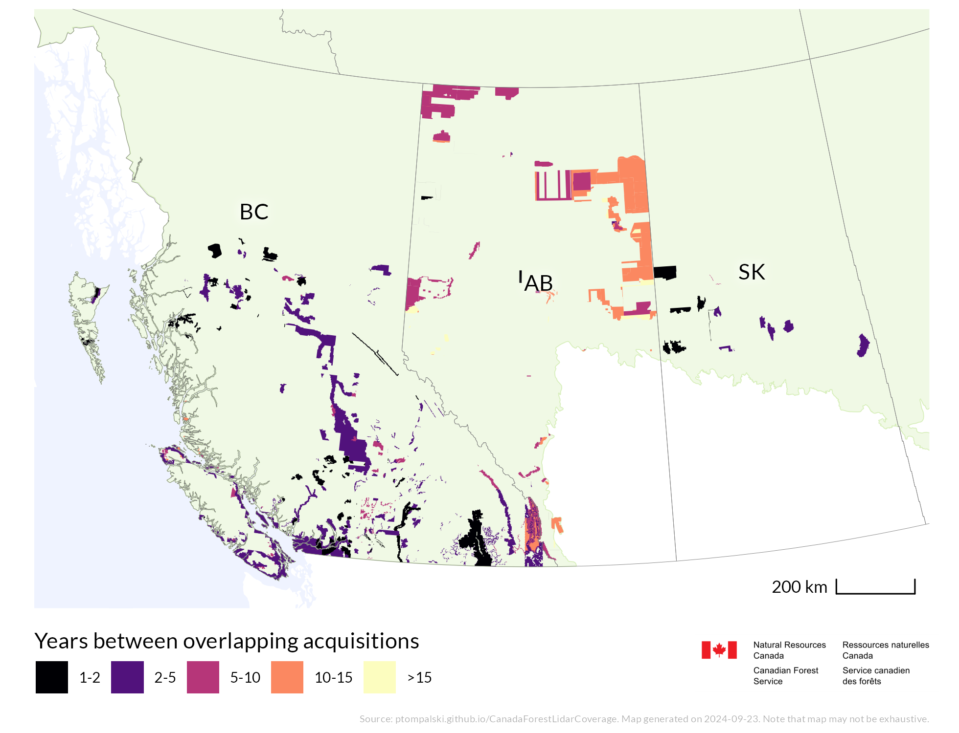
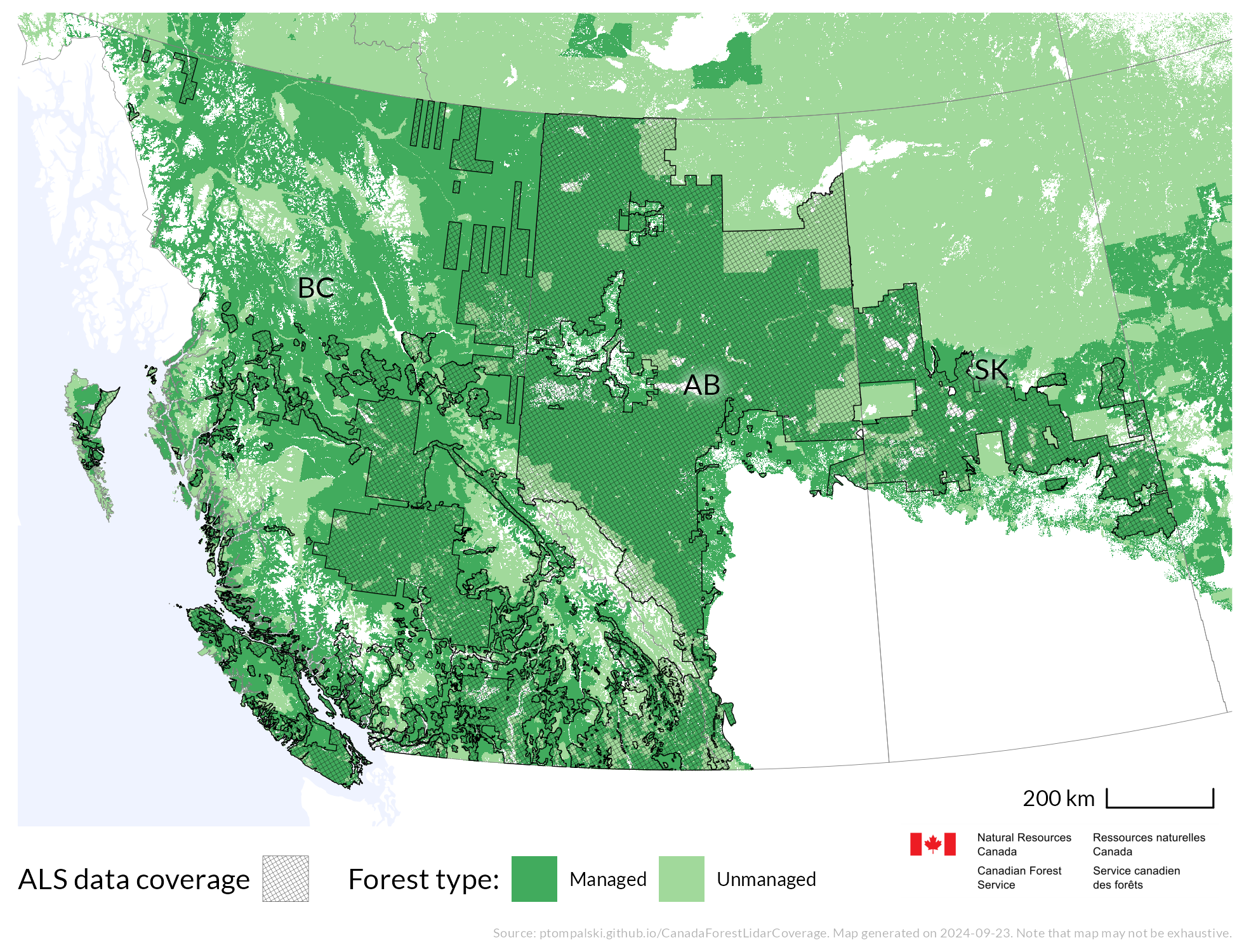
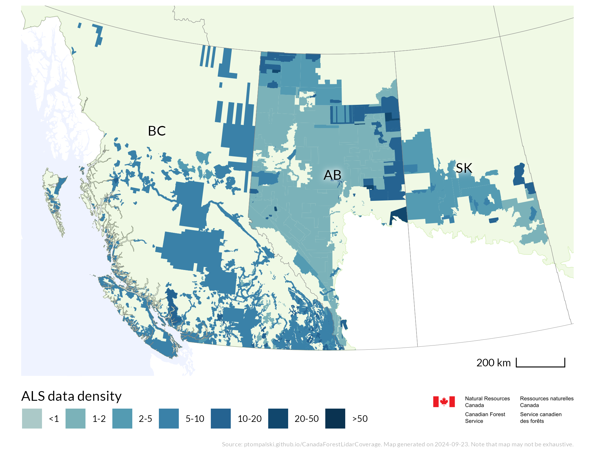
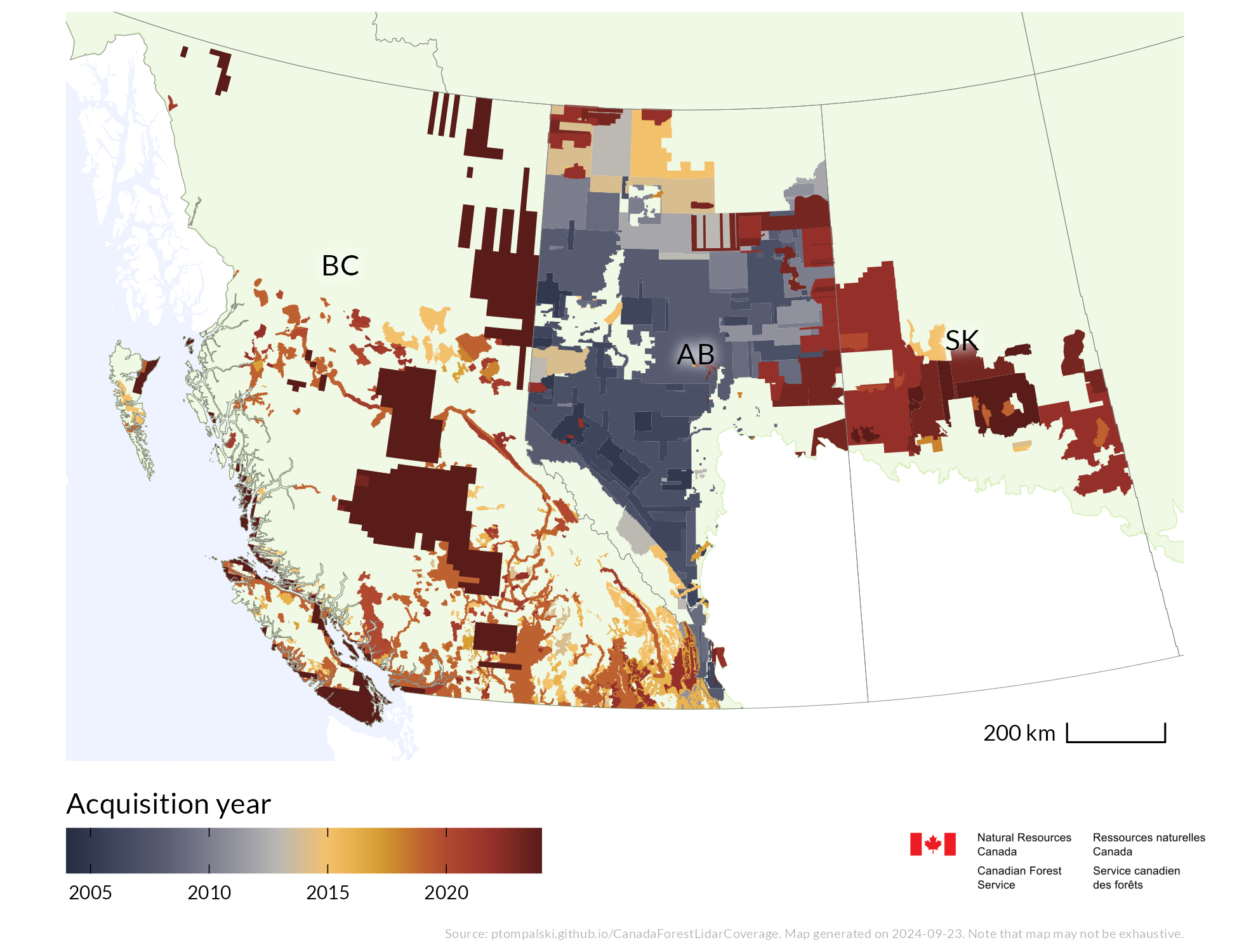
National and regional static map products show ALS coverage, point density, acquisition timing, and multitemporal overlap. They are updated as new acquisitions are added to the compilation.
ALS coverage
Point density
ALS acquisition year
Areas of multiple acquisitions